

Footpath Route Planner
Screenshots



Description
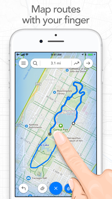
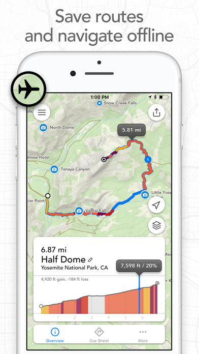
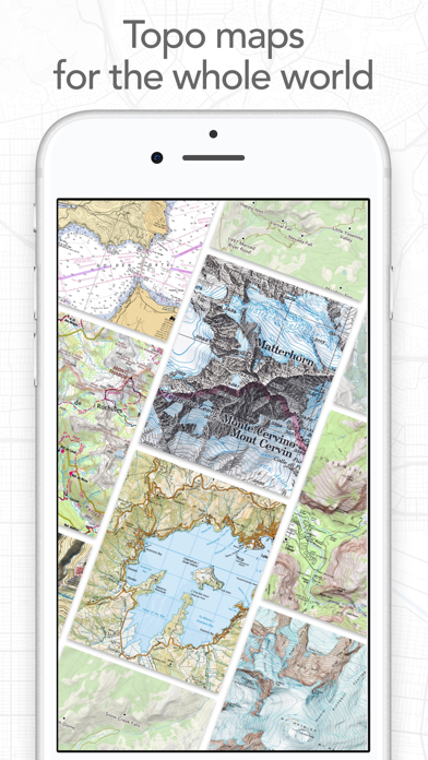
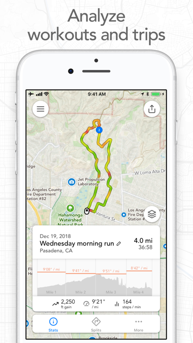
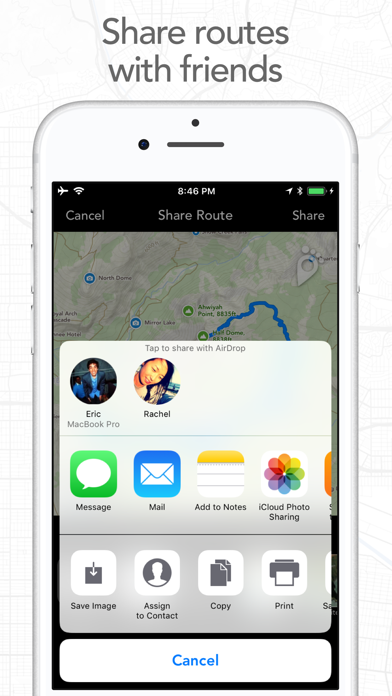
Map routes with your finger and Footpath will snap to roads and trails. Measure distances and elevations in seconds, then navigate along with turn-by-turn directions. Footpath is the ultimate companion for planning and navigating custom routes. Join millions of adventurers and plan out your perfect route. SNAP TO MAP Quickly measure distances by tracing a map with your finger or Apple Pencil. Footpath will snap to roads and trails on the map. MEASURE DISTANCE AND ELEVATION Know exactly how far and how high you'll travel with elevation profiles. Plan routes that match your goals. SAVE ROUTES FOR LATER Plan out your week or trip. Keep up to 5 routes on hand for reference, or save unlimited routes with Footpath Elite. SHARE ROUTES Send your routes to friends or workout partners to open on their device. Footpath is designed to work for pretty much any activity or adventure, in any country: • Running • Cycling and mountain biking • Hiking and mountaineering • Walking • Motorcycling and driving • Backcountry skiing • Kayaking and standup paddleboarding • Sailing • And many more! FOOTPATH ELITE Ready to go the extra mile? Upgrading to Footpath Elite unlocks the following powerful features: TURN-BY-TURN NAVIGATION - Footpath will tell you when to turn with turn-by-turn audio cues on your iPhone and Apple Watch - Save your route and cues in advance for voice guidance that works completely offline - Double tap your AirPods or use the playback controls button on your headphones to replay your next cue PREMIUM OFFLINE MAPS - 3D and topographic maps including Footpath Outdoors (Worldwide), USGS Topo Maps (U.S. and Canada), OpenCycleMap (Worldwide), and many more - Cycling lanes, avalanche slope shading, and elevation contour lines - Download maps for use offline - Save places as favorites to customize your maps ORGANIZE - Create and edit unlimited saved routes - Duplicate, merge, and split routes - Organize and sort routes into custom lists ANALYZE - Record GPS tracks of your activities - Use HealthKit display and log extra health and fitness metrics such as heart rate during a GPS activity - View a calendar log and weekly summary of your activities - Analyze splits, speed, elevation, and heart rate - View a heatmap of your speed during your activity EXPORT - GPX import and export - TCX and FIT course export for turn-by-turn navigation on Garmin and Wahoo GPS devices - Export cue sheets to a spreadsheet app for customization and printing - Export your routes and workouts to Apple Health You can purchase a Footpath Elite monthly or yearly subscription through your iTunes account. Your subscription will automatically renew unless cancelled at least 24 hours before the end of the current period. Auto-renew can be turned off anytime by going to the Manage Subscriptions page in settings after purchase, and your features will remain active until the end of the subscription period. Your account will be charged for renewal within 24-hours prior to the end of the current period at the same cost as your original purchase. TIPS FOR MAPPING ROUTES • For longer routes, try zooming in and mapping your route in multiple segments. • Tap and hold the map to quickly route between waypoints and POIs. • Did Footpath snap to the wrong roads? Trace over the incorrect segment to edit, or use the eraser tool. • Turn off snap to roads (magnet icon) and zoom in to manually trace the map. (Try switching to a satellite layer). • Displaying maps and continuously running GPS in the background can dramatically decrease battery life. Navigate without maps or with the screen off for all day battery life. CONTACT US We've got a lot planned for Footpath. If you have any suggestions or feedback, or if you run into any issues, please contact us at support@footpathapp.com Terms of Service: https://footpathapp.com/terms Privacy Policy: https://footpathapp.com/privacy
What's New
- Bug fixes Leave us an App Store review if you're enjoying Footpath, or feel free to contact us at support@footpathapp.com with any problems or suggestions.
Details
- Developer
- Half Mile Labs LLC
- Main Category
- Navigation
- Version
- 4.10.9
- Version Release
- 2026-04-09
- Initial Release
- 2013-05-07
- Size
- 116 MB
- Age Rating
- 4+
- Price
- Free
- Languages
- DA, NL, EN, FR, DE, IT and 6 more
- Bundle ID
- com.ericrwolfe.Footpath
- Version Rating
- ★ 4.80 (21,649)
- First Seen
- 2026-05-28
Metadata updated 2026-07-19
Rank History
Free · Max 90 days · Top 5 categories shown (Y-axis: rank, lower is better)
Free Rankings
Paid Rankings
No rankings
Competitive Benchmark — Navigation Top 10
What it takes to beat this app — comparison with the category's top apps. The orange row is the current app.
| # | App | Price | Rating | Ratings | Langs | Last Update |
|---|---|---|---|---|---|---|
| 1 | Google Maps | Free | ★ 4.68 | 7,277,988 | 42 | 2026-07-17 |
| 2 | Waze Navigation & Live Traffic | Free | ★ 4.84 | 3,178,197 | 47 | 2026-07-09 |
| 3 | ParkMobile: Park. Pay. Go. | Free | ★ 4.76 | 1,333,259 | 21 | 2026-07-13 |
| 4 | SpotHero: #1 Rated Parking App | Free | ★ 4.86 | 400,335 | 1 | 2026-07-13 |
| 5 | Transit • Subway & Bus Times | Free | ★ 4.63 | 959,227 | 9 | 2026-07-10 |
| 6 | MTA TrainTime | Free | ★ 4.88 | 211,098 | 6 | 2026-07-16 |
| 7 | Metropolis: Remarkable Parking | Free | ★ 4.86 | 45,081 | 1 | 2026-07-09 |
| 8 | onX Offroad: Trail Maps & GPS | Free | ★ 4.41 | 8,996 | 1 | 2026-07-15 |
| 9 | Shell: Fuel, Charge & More | Free | ★ 4.78 | 87,359 | 2 | 2026-06-29 |
| 10 | earnify | Free | ★ 4.86 | 69,246 | 1 | 2026-06-29 |
| 97 | Footpath Route Planner | Free | ★ 4.80 | 21,649 | 12 | 2026-04-09 |
User Reviews
Please add change of colors, and arrows in directions to follow along love the concept though
Yeas
I’ve never left a review on the App Store but I’ve been using this app for about a month and it’s exactly what I was looking for. I can plan a route and see how many miles it’ll be and I can track my route to see my pace and how far I’ve gone. That’s all I need and this app is so simple and perfect for that! Devs, pls don’t change a thing
A great app for finding trails and custom driving routes. I started using this app as a metro bus driver to help me save and learn routes. Some streets didn’t snap, but it has the option to manually draw routes. As a hiker and trail runner, I have gotten to love this app to plan my runs. It shows both paved trails and dirt trails. It allows me to categorize the trails or routes in groups. And the subscription price is reasonable.
I’ve been having too much fun drawing gravel bike routes to explore (and then riding them) . The drawing function - on an iPad - is excellent, and the app is really well designed (good set of features) and well implemented (haven’t hit a bug yet). It’s not so useful unless you subscribe to store maps, but the annual cost is entirely reasonable. And they don’t ensnare you into some social media/advertising scheme (which I hate) as most apps do. Perfect for road, gravel, mountain bike route planning
First, if you are on a hike and decide to turn back for any reason you need to stop the hike you are currently on, and program a new hike beginning at your current location and ending at your starting location. To me, this is a huge safety flaw as returning to start point is likely to be your first choice when something goes wrong during your hike (injury, unexpected conditions on the trail, unexpected weather changes, etc.). This should be an easy to use feature with one button or easy-to-find screen option. In short, the app is great for planning a hike, but not so great at keeping you safe if things change. Second, on the Apple series watches it is difficult to toggle between the map-screen and the cue-sheet as the icons are small with a confusing layout. (No direct toggle). Apparently, it’s easier on the Apple Watch Ultra as that watch has a function button that can be programmed to do this.
Very easy to use & create my running routes. I love this app!
It's simple,the only thing is that I wish it was sorta like Google maps where you could like do a start and finish and it shows where you've already ran at
This app has been incredibly useful as I train for longer distances and need to plan those runs for specific lengths. Especially valuable when you’re trying to get a certain distance while traveling somewhere you’re not used to. It’s so well-designed for that purpose that I’m surprised when little user experience quirks pop up: for example, while it’s very clear how to start creating a route, saving it can only be done if you intuit that the icon usually meaning “share” or “export” (a box in the upper right-hand corner of the route-editing screen) is actually what you tap to do that. I have other small kvetches but they shouldn’t obscure the fact that this is a great tool that I highly recommend.
It does what it’s meant to do!
It’s the best app
Really cool app until it completely quit working. Tried multiple devices but it just freezes up and quits
Reviews are collected only for apps with detected changes (new entries or sharp risers).