

Organic Maps・Offline Maps, GPS
Screenshots


Description
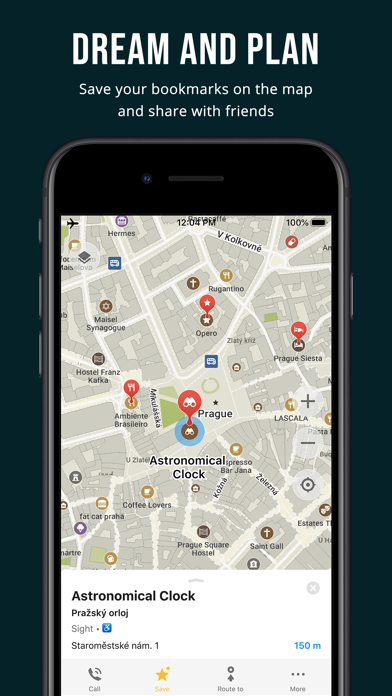
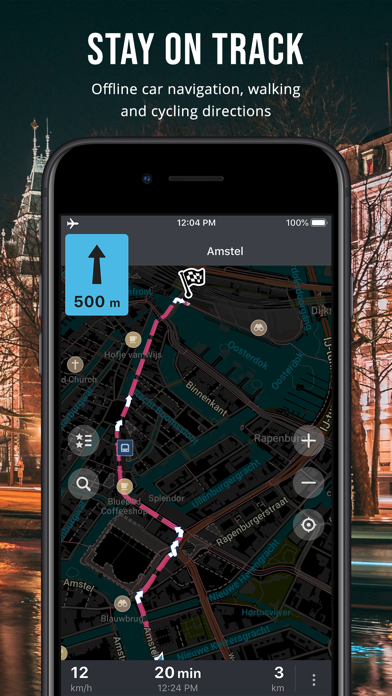
Organic Maps is a fast, detailed offline map and GPS navigation app for travel, hikes, and rides. Plan, import, and record routes, and enjoy smooth guidance without draining your battery or using an internet connection. Explore places and navigate safely during your outdoor adventures and travels around the world. The app offers unlimited map downloads and biweekly updates. OpenStreetMap-based, volunteer-made, privacy-first, 100% offline, and 100% free. OFFLINE: The app works 100% offline — including search and navigation. You can explore the map and navigate without an internet connection, saving on mobile data and roaming fees. And with no background data transfers, your battery lasts much longer. FAST: Zooming, search, and route calculations work noticeably fast. DETAILED & UPDATED: The maps are rich in detail and refreshed twice a month to reflect real-world conditions. Unlike many well-known competitors, they include building labels, benches, hiking paths, and other helpful information. OPENSTREETMAP-BASED: OpenStreetMap is a wiki-style world map built and maintained by millions of volunteers — locals who know their areas best. This community effort results in highly detailed maps, often more accurate than commercial ones in less-mapped regions. Organic Maps updates its data from OpenStreetMap every two weeks, keeping your maps fresh and reliable. And if you notice something missing, you can add it to OpenStreetMap and help improve the map for everyone. PRIVACY-FIRST: We don’t collect any data or identifiers. This means there’s no risk of data leaks and no distractions like ads or noisy notifications — just a clean, private map experience. IMPORTANT FEATURES EXPLORE PLACES: Search by address, name, or category, discover millions of POIs, and view detailed information such as opening hours, Wikipedia articles, wheelchair accessibility, and other helpful details. All available offline. GPS NAVIGATION: Enjoy voice-guided, turn-by-turn directions. Create walking, hiking, cycling, or driving routes — including routes between cities, countries, and multiple waypoints. Find the best routes for your metro journeys and commutes. CarPlay is supported. HIKING & CYCLING TRAILS FROM AROUND THE WORLD: Enable special map layers to discover popular hiking and cycling routes worldwide, all sourced from OpenStreetMap. Switch between layers to see colored bike and MTB routes, as well as official hiking paths. PUBLIC TRANSPORT: See public transport route numbers at stops. Live transport schedules and routing are currently in development. MAP STYLES: Choose map layers that fit your activity — Outdoors, Contour Lines, Hiking, Cycling, or Metro/Subway. TRACK RECORDER: Record, import, export, and share your routes and favorite places. Supports KML, KMZ, GPX, and GeoJSON formats. WIKIPEDIA ARTICLES: Explore Wikipedia articles for places you discover on the map. Type “?wiki” in the search to find all places with Wikipedia articles. MAP EDITOR: Contribute to OpenStreetMap by adding missing places or editing the map directly from Organic Maps. DARK MODE: Switch to a dark theme for comfortable viewing at night. iCLOUD SYNC: Easily back up and sync all your bookmarks and tracks via iCloud. Try the app — it’s 100% free, ad-free, fast, and fully offline. Enjoy a fast, reliable, and private map experience, and share it with others! Organic Maps is an indie, community-driven, open-source project with hundreds of contributors who help develop new features, fix issues, translate, and move the project forward. Join the community on Telegram: @OrganicMapsApp Or learn other ways to support the project: https://organicmaps.app/contribute/ Your honest feedback and reviews in the store motivate us! We love hearing from you there. Have questions? Please visit the organicmaps.app website for additional details and FAQ.
What's New
- NEW! Public transport routing by subway, light rail, bus, and tram - NEW! Alternative routes: in addition to the fastest route, the app now shows the shortest route - NEW! Walking and cycling route warnings about steps, gates, and lift gates along the way - NEW! Tap to choose between overlapping tracks and routes - NEW! Select any color for bookmarks - NEW! Support for British National Grid (OS Grid), Irish Grid, and Irish Transverse Mercator (ITM) coordinates - NEW! Accessibility support for Dynamic Type and large fonts - EXPERIMENTAL: Enable Satellite Imagery in Organic Maps settings with a custom raster tile server URL - Cleaner table styling in the UI - Type `?map-download-server:https://your-server.com/` in the search window to override the Organic Maps map download servers. Type `?no-map-download-server` to remove the override. - Various bug fixes and performance improvements ## Map Data - OpenStreetMap data updated as of June 24 - Wikipedia data updated as of June 20, including articles in Italian ## Map rendering & styles - Better-looking patterns for beach, sand, scree, bare rock, orchard, and vineyard areas, plus protected area and wetland hatching - Smoother curved text labels for roads and rivers - Rivers, streams, and wetlands have higher contrast and are more visible in dark mode - New and improved icons for category search and search results on the map - Improved multilingual text shaping and rendering on the map ## Tracks, bookmarks & routes - Improved HTML rendering of bookmark and track descriptions - GeoJSON tracks now keep elevation and timestamps on import and export - Fixed a crash after moving a track to another list - Websites are now shown for heritage sites - Operator names are now shown for unnamed search results. For example, an unnamed ATM now shows its bank - Editor: corrected the description text for apartment-building OpenStreetMap edits/changesets - Improved HTML detection in bookmark and track descriptions - Duplicate routes are now filtered out ## Translations - Cantonese turn-by-turn voice guidance - Updated German and French translations - Fixed incorrect "onto street" voice guidance translations for Chinese, Serbian, and Catalan
Details
- Developer
- Organic Maps
- Main Category
- Navigation
- Version
- 2026.06.24
- Version Release
- 2026-06-27
- Initial Release
- 2021-06-12
- Size
- 134 MB
- Age Rating
- 4+
- Price
- Free
- Languages
- AF, SQ, AR, HY, AZ, EU and 42 more
- Bundle ID
- app.organicmaps
- Version Rating
- ★ 4.75 (2,495)
- First Seen
- 2026-05-28
Metadata updated 2026-07-19
Rank History
Free · Max 90 days · Top 5 categories shown (Y-axis: rank, lower is better)
Free Rankings
Paid Rankings
No rankings
Competitive Benchmark — Navigation Top 10
What it takes to beat this app — comparison with the category's top apps. The orange row is the current app.
| # | App | Price | Rating | Ratings | Langs | Last Update |
|---|---|---|---|---|---|---|
| 1 | Google Maps | Free | ★ 4.68 | 7,277,988 | 42 | 2026-07-17 |
| 2 | Waze Navigation & Live Traffic | Free | ★ 4.84 | 3,178,197 | 47 | 2026-07-09 |
| 3 | ParkMobile: Park. Pay. Go. | Free | ★ 4.76 | 1,333,259 | 21 | 2026-07-13 |
| 4 | SpotHero: #1 Rated Parking App | Free | ★ 4.86 | 400,335 | 1 | 2026-07-13 |
| 5 | Transit • Subway & Bus Times | Free | ★ 4.63 | 959,227 | 9 | 2026-07-10 |
| 6 | MTA TrainTime | Free | ★ 4.88 | 211,098 | 6 | 2026-07-16 |
| 7 | Metropolis: Remarkable Parking | Free | ★ 4.86 | 45,081 | 1 | 2026-07-09 |
| 8 | onX Offroad: Trail Maps & GPS | Free | ★ 4.41 | 8,996 | 1 | 2026-07-15 |
| 9 | Shell: Fuel, Charge & More | Free | ★ 4.78 | 87,359 | 2 | 2026-06-29 |
| 10 | earnify | Free | ★ 4.86 | 69,246 | 1 | 2026-06-29 |
| 57 | Organic Maps・Offline Maps, GPS | Free | ★ 4.75 | 2,495 | 48 | 2026-06-27 |
User Reviews
it’s not intuitive
I’m really annoyed by all these POI symbols that covers the map and inability to switch them off or adjust makes me literally scream… the maps is great, the app is great… bit I can not use it because of these stupid POIs…
As good or better than apps that cost!
I found out about Organic Maps via F-Droid; thanks for sharing it there! I mostly use a combination of paper maps and writing down directions from Organic Maps, then stowing the computer.
It is the best and most trusty privacy and free option that I have found. A great good job. thank you developers for it. I appreciate it. Highly recommended!
Download and search OSM data off line. Great to have for when cell service is not available.
What is useful about a map that has no addresses
Great app and great use. Thanks
Was great, until greed started to poke its ugly head.. suggest people take a look at CoMaps instead
The ap makes planning and implementing this massive undertaking attainable. I love the way it tells you where you are, where you’ve been and what’s up ahead. I am NOT a tech person, yet this ap makes use easy and intuitive.
В каких то моментах даже удобнее, чем платная прога gurumaps pro, которой давно пользуюсь. Она тоже хорошая, но сейчас я на этой)
Easy to import geojson and kml data
Reviews are collected only for apps with detected changes (new entries or sharp risers).