
Earth Maps
🇰🇷 KR LocalizedScreenshots
Description
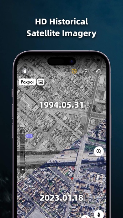
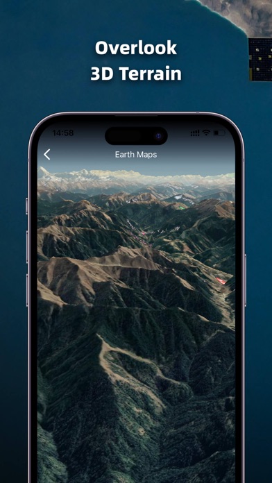
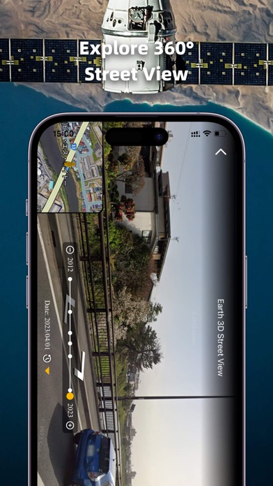
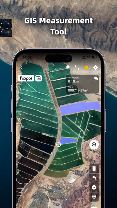
1. High-definition 3D globe 2. Load map tile data 3. Oriental compass function 4.historical street view 5.Measuring area distance 6.latest satellite imagery World Satellite Map allows you to view any place on Earth using photos taken from satellites. The advantage of the world satellite map over other maps is that the satellite map allows you to consider the surface terrain, forests, rivers, lakes, buildings, roads in sufficient detail with a high degree of detail. With satellite maps, you can travel the world online without leaving your phone. From world satellite map.
What's New
1.Optimize the UI layout and interaction logic of the location info pop-up on homepage. 2.Upgrade service capabilities of customer service assistant.
Details
- Developer
- FOXPOI PTE. LTD.
- Main Category
- Navigation
- Version
- 1.2.06
- Version Release
- 2026-07-02
- Initial Release
- 2022-12-01
- Size
- 78 MB
- Age Rating
- 4+
- Price
- Free
- Languages
- AR, BN, EN, FR, FA, RU and 4 more
- Bundle ID
- com.foxpoi.globeios
- Version Rating
- ★ 4.81 (1,133)
- First Seen
- 2026-05-28
Metadata updated 2026-07-19
Rank History
Free · Max 90 days · Top 5 categories shown (Y-axis: rank, lower is better)
No rank history data
Free Rankings
No rankings
Paid Rankings
No rankings
User Reviews
ㅋㄹㄹㅈㄴㅋㅌㅌㅌ
ㅛㅛ
아니 광고 많은건 그렇다 처도 동해를 일본해로 표시해놈 추천하지는 않음
광고가 5초씩 계속나옴 들어가면 광고,광고 밖게없음 구글어스랑차이는없음 그런데 구글어스는 정보가 더 리얼함 광고 많이나와서 추천은안함
Easy to use more than Google map
너무 잘보입니다
굳
好用
Good
구글어스랑 차이없고 광고도 5초짜리 밖애 안뜨는데 진짜 리얼함 강력 추천
다른건 다 좋은데 짧은 광고 있음. 가장 심한건 무슨 동해를 일본해로 표시해 놓은 거;; to. 开发者们大家好! 东海就是韩国的海!请把“日本海”这个词改掉😀
Reviews are collected only for apps with detected changes (new entries or sharp risers).