
NZ Topo50 South Island
🇯🇵 JP LocalizedScreenshots
Description
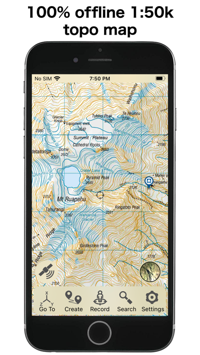
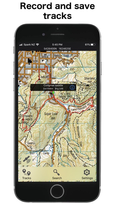
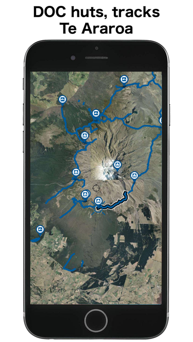
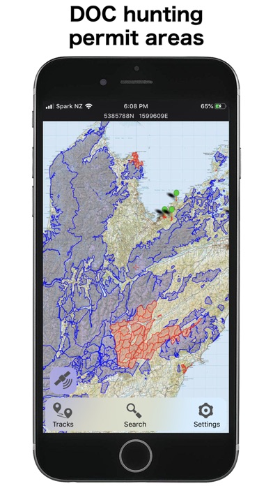
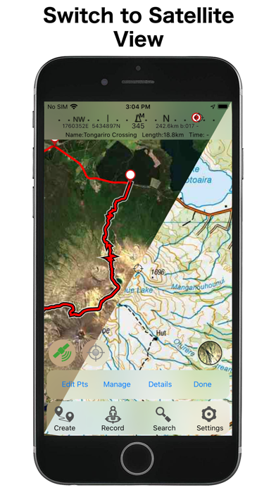
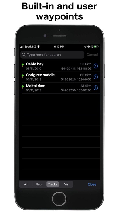
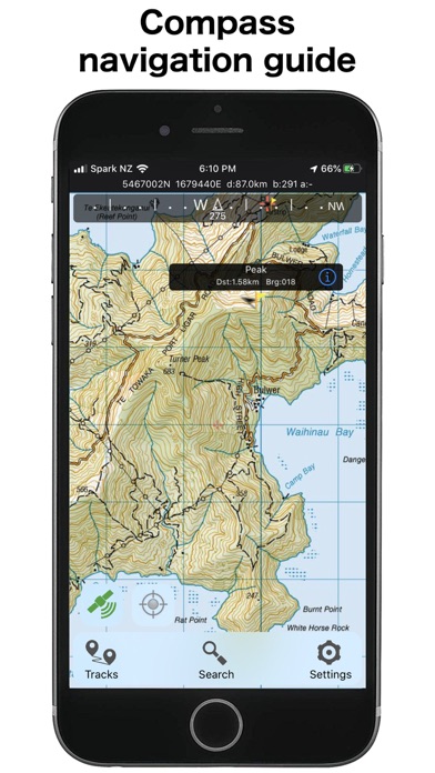
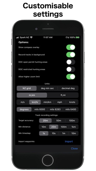
This app provides complete offline topographic map coverage of the South Island of New Zealand from the LINZ Topo50 1:50k scale map series. The maps are all contained in the installation so there is no additional need for downloads, no need for phone or wifi signal, no slow server issues, no account signups, no missing tiles, and no additional map fees. Just install for seamless off-line zooming and panning across the whole island down to 1:50k scale. The app also includes 1:50k resolution satellite images for the island, and elevation data. Additional aerial imagery can be downloaded. Other integrated data includes DOC hunting permit boundaries, DOC huts, campgrounds, and tracks, Fish and Game access points, Te Araroa trails, Public Conservation Land boundaries, selected public road parcels, and many more. The app has a full suite of navigation functions including GPS location, compass orientation, distance to map locations, track recording and graphing, route creation and following, hillshade and slope angle overlays, import/export of gpx and kml files, search functions for named places and user data. Add and edit your own locations and routes and plot elevation profiles. Set proximity alarms. Live location sharing. Use your camera view to identify surrounding peaks and match with local topography. Uses an intuitive simple interface with one-touch access to all functions. LINZ TOPO250 series maps are used at lower zoom levels for easier navigation. Perfect for outback use out of cell phone range. GPS and maps function fully without phone coverage. No need to cache files in advance either as they are all fully installed with the app. Popular with trampers, hikers, runners, bikers, search and rescue (SAR), hunters, boaters, flying, paragliding, as well as survey applications. Note that continuous use of GPS will run down the battery faster than when not using the GPS. The NZTopo50 app gives you full control over when GPS is used. The map can be used without GPS, intermittently with GPS for spot checking of location, continuously for logging while the app is open, or for continuous background logging when the phone is off. Check our website for links to user guides and useful tips and tricks. The in-app purchases are for an optional contribution to ongoing app development, or for selected additional third party data sets. They don't affect the functionality of the app or the availability of updates. Feel free to get in touch with any suggestions.
What's New
Minor layout changes
Details
- Developer
- Right Place Resources
- Main Category
- Navigation
- Version
- 6.03.03
- Version Release
- 2026-05-09
- Initial Release
- 2013-02-27
- Size
- 2.8 GB
- Age Rating
- 4+
- Price
- USD 3.99
- Languages
- EN
- Bundle ID
- sqrl.net.NZTopo50.SI
- Version Rating
- ★ 4.11 (9)
- First Seen
- 2026-05-28
Metadata updated 2026-06-12
Rank History
Free · Max 90 days · Top 5 categories shown (Y-axis: rank, lower is better)
No rank history data
Free Rankings
No rankings
Paid Rankings
No rankings
More by This Developer
User Reviews
I can’t believe it’s so cheap to have topo maps of the whole island! Lovely routemaking tools too
I used it for navigating a number of different tracks and it worked flawlessly. Also, the search feature is handy for exploring areas.
These maps only show little floating bits of trails (tracks), not the complete ones. It’s impossible to tell where they go or how they connect to each other
NZ topo50 South Island doesn't have waypoints features which is already available in NZ topo50 North Island applications. The feature is at least required for offline map apps, I think. Importing kml files feature is also helpful for outdoor activities. Hopefully these features will be included in next update, but basically this is great app. Beautiful map, easy to use, stable move, quick response with even my iPhone 4!
Reviews are collected only for apps with detected changes (new entries or sharp risers).