Firesource - Live Wildfires
Screenshots
Description
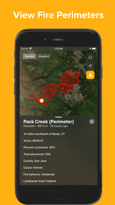
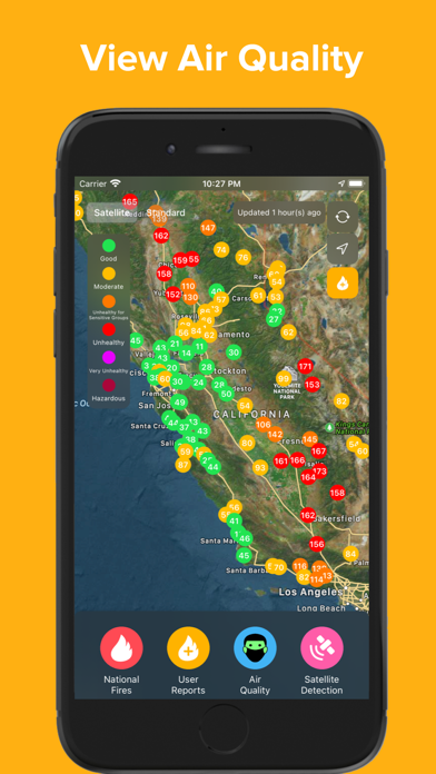
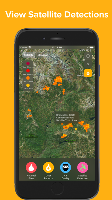
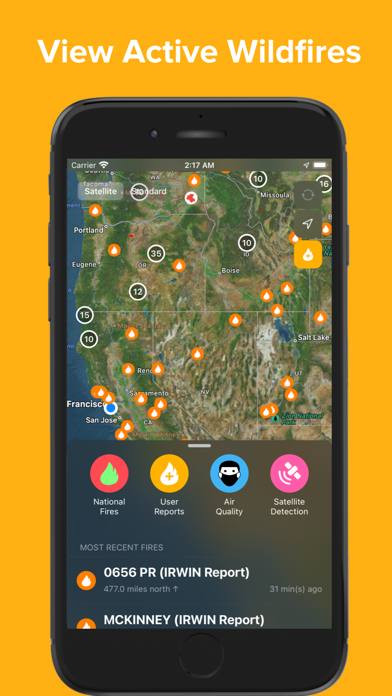
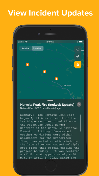
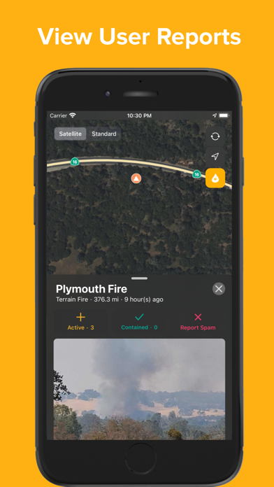
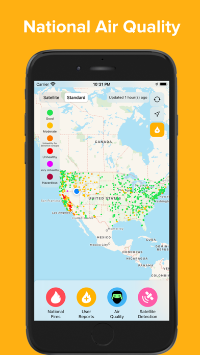
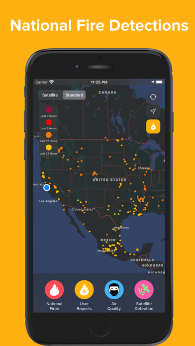
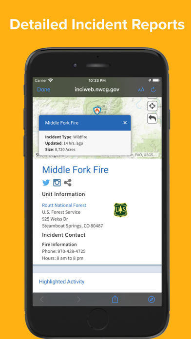
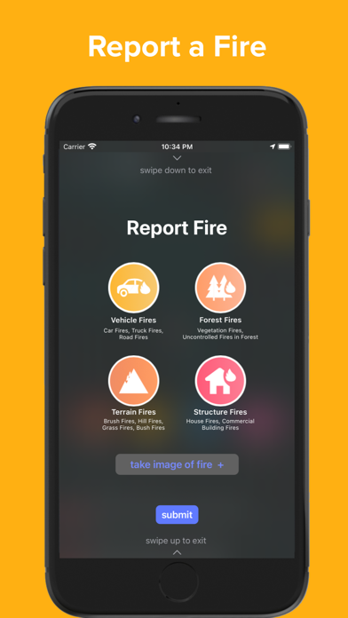
Firesource’s features: ◦ Live fire feed - both on map and in scrollable menu ◦ Local and national fire incidents - news updates and reports ◦ Fire perimeters - access all realtime fire perimeters at once with information about fire growth and progress, including acreage, containment, personnel, fire cause, and fire behavior ◦ Report a fire - instantly inform other users of a nearby fire by pressing the + button, taking a picture of the fire, and submitting ◦ Air quality - see the effects of recent fires by viewing realtime air quality measurements across the country ◦ Satellite fire detections can indicate new fires and how current fires are spreading National Fires (InciWeb, Cal Fire, IRWIN): InciWeb is an interagency incident management system run by the National Wildfire Coordinating Group. InciWeb collects wildfire incident data from several agencies across the United States and provides all of this data together in several feeds. Firesource presents wildfire incidents reported by InciWeb in real time, providing the fire’s location and detailed status. Learn more about InciWeb at their website: https://inciweb.nwcg.gov/. Learn more about Cal Fire, which also provides incident information, at their website: https://www.fire.ca.gov. Learn more about IRWIN, the data hub of fire reports, at https://www.forestsandrangelands.gov/WFIT/applications/IRWIN/. National Fires (Perimeters): Perimeter data is provided by the Wildland Fire Interagency Geospatial Services (WFIGS) Group and hosted in the National Interagency Fire Center ArcGIS Online Organization (The NIFC Org). Firesource displays fire perimeters and descriptions of their progress in the ‘National Fires’ tab of the menu, with this information updated on a regular basis. Learn more about the NIFC at their website: https://www.nifc.gov User-Reported Fires: Allowing app users to report a fire and immediately inform other users is an essential aspect of Firesource. To report a fire, press the yellow + button in the top right corner of the map, select the type of fire (vehicle fire, forest fire, terrain fire, structure fire), take a photo of the fire, and press submit. To ensure the validity of fire reports, the user must take a photo of the fire and cannot access Camera Roll to select a picture. Please note that submitting a fire report automatically creates the report at the user’s location, to further ensure that the fire is local and valid. When viewing user-reported fires in the feed, other users can ‘rate’ the fire report by confirming that it is active, contained, or a spam reporting. Air Quality: Air quality measurements from across the United States are collected from AirNow.gov, which provides national air quality data using the Air Quality Index (AQI). This data is color-coded to provide information about health concerns due to PM2.5 pollutants. Satellite-Detected Fires: Thermal hotspot detections are displayed and collected from NASA’s Moderate Resolution Imaging Spectroradiometer (MODIS), which is an instrument on the Terra and Aqua satellites. Information provided from MODIS about each detection includes brightness (brightness temperature in Kelvin of a fire pixel) and confidence (quality of fire pixel). These fire detections are extremely useful, as they can indicate new fires and fire spread. Learn more about MODIS at their website: https://modis.gsfc.nasa.gov Firesource is not affiliated with any government agencies. Firesource is only available for iPhone and iPad in the United States, Canada, and Australia. Privacy Policy: https://firesourceapp.weebly.com/privacy-policy.html Learn more and contact us at https://firesourceapp.weebly.com/
What's New
- UI/UX improvements - Bug fixes
Details
- Developer
- Hemal doshi
- Main Category
- Weather
- Version
- 1.2.5
- Version Release
- 2023-04-11
- Initial Release
- 2020-06-13
- Size
- 38 MB
- Age Rating
- 4+
- Price
- Free
- Languages
- EN
- Bundle ID
- com.hemaldoshi.Firesource1
- Version Rating
- ★ 4.65 (2,422)
- First Seen
- 2026-06-24
Metadata updated 2026-06-25
Rank History
Free · Max 90 days · Top 5 categories shown (Y-axis: rank, lower is better)
Only 2 day(s) of data collected. More data will reveal meaningful trends.
Free Rankings
No rankings
Paid Rankings
No rankings
User Reviews
Only shows area burned at time of discovery and never updates. At present, it shows the Lee fire at 50 acres— it has burned over 130,000. It also does not show a fire boundary.
NOT accurate so far! Pretty disappointed-just downloaded this app today as the Grand Canyon Dragon fire just turned MEGA, & our air quality at Page/Lake Powell is VERY POOR. Have heard that the fire is moving closer to the small communities between Grand Canyon and Page, wanted to track the fire and smoke. The Grand Canyon DRAGON/MEGA Fire is NOT EVEN ON THE MAP!! Instead over half of UT is on fire—according to the map—but we were told that a lot of those fires were mostly contained. Oh, and air quality in AZ is showing green-meaning good. IT IS NOT. I’ll keep this app for a few days, see if things improve, but NOT IMPRESSED thus far. 😤
Great for road closures on our trip through Colorado
I live in a wooded area, and with all the fire warnings in Texas, I like knowing where fires are in my area.
Fires all over Oklahoma around Stillwater, Mannford and many other areas and not much of anything is showing up.
I use Firesource as one of my apps for research. It’s a nice addition to have for quick fire records.
You commented on the wrong app. This app is mediocre at best
Cant report exact location or adjust location after. Stopping AT THE FIRE SITE is stupid and dangerous. Cant report without photo but you CANT ACCESS ALREADY TAKEN PHOTOS. Other than national fires this app is a joke.
As a few others have mentioned, a horizontal format would be useful. I’d also like to be able to sort the active fires by distance to my location in addition to the times the fires started. Thanks for all your work on this important app.
Need this for iPad viewing
Reviews are collected only for apps with detected changes (new entries or sharp risers).