스크린샷
설명
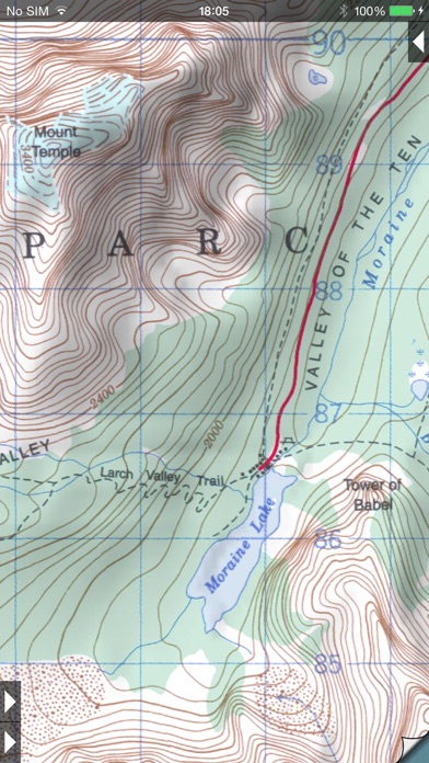
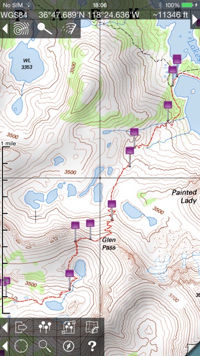
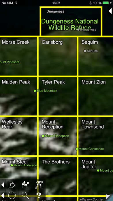
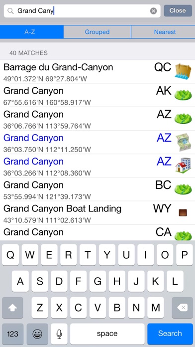
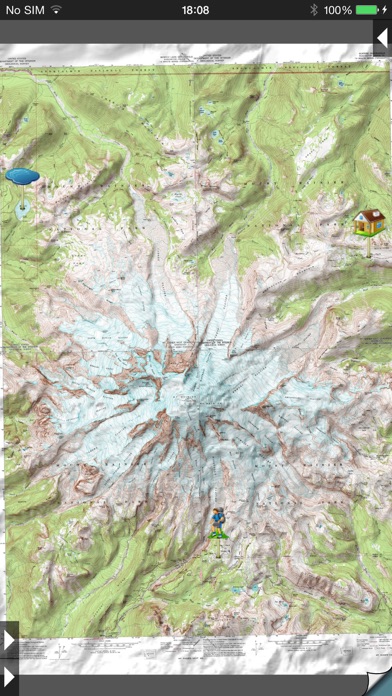
* View over 70,000 Natural Resources Canada 1:50,000 and USGS 1:24,000 topographical maps on your iPhone or iPod touch. * Ideal for hiking and other backcountry activities. * Map downloads are FREE! * More than 16 million maps downloaded so far! - iPad owners, please see the app "Topo Maps for iPad". * Users write: " I've bought all the topo map apps and I like this the best " " Scans are gorgeous ... the interface is exceptionally clean " " Downloading maps is easy and fast ... Map displays beautifully and zooms flawlessly " * Includes Canada (at 1:50,000), the contiguous US (at 1:24,000), Alaska (at 1:24,000 and 1:63,360), Hawaii, Puerto Rico and the U.S. Virgin Islands. * Locate the maps you need on the satellite view. To install a map, touch for about half a second. Touch again to view it. * Search by name for over a million towns, peaks, lakes, parks and other features. * No network connection is needed once the maps have been installed. * Mark waypoints, and import and export waypoint files in GPX, KML and CSV formats. * Touch the "current location" button to see where you are, and the compass button to align the map with the ground. * See coordinates in NAD27 or WGS84 degrees, degrees minutes and seconds, UTM, or MGRS formats. * Measure distances (miles, feet and km) and bearings (true and magnetic). The Maps: This app uses high-quality scans of the traditional USGS and NRCan topographic maps which have been the definitive resource for hikers and other backcountry users for many years. You can make the terrain stand out with hill shading, using simulated sunlight from the direction of your choice. In the U.S., this app does not use the new "US Topo" maps because they do not show hiking trails and lack other details: please see the web site for more details. Downloading: US maps are around 8 MB in size and download in a few seconds on a typical home broadband connection. Canadian maps are larger. Both cellular data and WiFi can be used, though WiFi is likely to be more reliable in most cases. - Do please visit https://topomapsapp.com/ for complete instructions, so that you don't miss any features. We have many ideas for additional features to add to future versions of this app; if you have ideas or other questions or comments, contact details can be found on the website, https://topomapsapp.com/. The website also has more screenshots and other information.
새로운 소식
This is a minor update to fix bugs.
상세 정보
- 개발사
- Mappendix Limited
- 주 카테고리
- Navigation
- 현재 버전
- 1.19
- 버전 출시일
- 2023-04-18
- 최초 출시일
- 2009-03-27
- 용량
- 112 MB
- 연령 등급
- 17+
- 가격
- USD 19.99
- 언어
- EN
- 번들 ID
- org.chezphil.topomaps
- 현재 버전 평점
- ★ 4.32 (127)
- 첫 수집
- 2026-05-31
메타데이터 갱신 2026-07-19
순위 히스토리
무료 기준 · 최대 90일 · 상위 5개 카테고리 표시 (Y축: 순위, 낮을수록 상위)
순위 히스토리 데이터가 없습니다
무료 순위
순위 없음
유료 순위
경쟁 벤치마크 — Navigation Top 10
이 앱을 이기려면 무엇이 필요한가 — 같은 카테고리 상위권과의 비교입니다. 주황색 행이 현재 앱입니다.
| # | 앱 | 가격 | 평점 | 리뷰 수 | 언어 | 최근 업데이트 |
|---|---|---|---|---|---|---|
| 1 | MilGPS | USD 12.99 | ★ 4.83 | 5,506 | 1 | 2026-06-20 |
| 2 | Solocator - GPS Field Camera | USD 0.99 | ★ 4.27 | 413 | 1 | 2026-04-04 |
| 3 | Land Nav Assistant | USD 2.99 | ★ 4.48 | 73 | 1 | 2019-04-08 |
| 4 | Blitzer.de PRO | USD 0.49 | ★ 4.33 | 21 | 11 | 2026-06-30 |
| 5 | Sun Seeker - Sunlight Tracker | USD 11.99 | ★ 4.84 | 12,794 | 5 | 2026-07-10 |
| 6 | Sporty's E6B Flight Computer | USD 9.99 | ★ 4.90 | 5,287 | 1 | 2024-02-17 |
| 7 | Exit Strategy NYC Subway Map | USD 3.99 | ★ 4.76 | 187 | 1 | 2026-07-16 |
| 8 | Omaha Zoo - ZooMap | USD 0.99 | ★ 1.35 | 46 | 1 | 2023-09-11 |
| 9 | Find93 | USD 4.99 | ★ 3.67 | 18 | 1 | 2026-04-14 |
| 10 | Speedometer 55 Pro. GPS kit. | USD 3.99 | ★ 4.71 | 2,715 | 11 | 2026-07-05 |
| 72 | Topo Maps | USD 19.99 | ★ 4.32 | 127 | 1 | 2023-04-18 |
이 개발사의 다른 앱
유저 리뷰
OCTOBER 2025: The issue with being unable to download new maps to my device has been fixed. when trying to download new maps, I would get an error message saying the map wasn’t available for download or something like that. I sent an email to the app developer last night, and six hours later he had responded and said the problem was fixed. And it really was! After all these years, this is still the best topographic map app out there for use in conjunction with hiking and exploring.
I'm a land surveyor and this app comes in extremely useful. The quads are pretty well registered and the contours are quite accurate. The biggest downside is that many of the usgs quads are not current.
I’ve been using these topo maps for years - pretty much everywhere I go I download the local area with these maps if I’m going to be out and about at all. Also, where I live I like to explore the back country, often overland with no trails or roads or on old two-track roads hours away from anywhere with cell service. These maps have been invaluable for offline use. I would say, however, that the most interesting use has been the fact that the old WGS84 took maps this app uses show a huge amount of things that modern maps omit. Old structures, mines, prospects, old roads, trails, and miscellaneous items that have been forgotten by all - including modern cartographers - are shown on these maps. A lot of these old things are still around, and are still visible even on satellite maps, but if you were only using modern (non-satellite) maps you would never know they were there many times. I love detail, and I hate how modern maps ignore so many different features that are in fact extant. These maps are perfect in ways so many other newer maps fail. A few things I wish it had though: 1. The ability to add kml files, including tracks and shapes etc. 2. A mode where the gps would still track but not force you to be centered on your position. The second tap just shows where you were when you tapped it the second time. 3. The ability to switch between a height map and the gps elevation. The app currently uses a hidden elevation map (the same thing it uses for the line of sight feature) to tell you your elevation, not the gps. There can often be pretty drastic differences between your actual elevation and the elevation it shows. I’ve seen these when I’m flying my plane a number of times. 4. All of the above without a subscription and add on features you have to pay for as well (like the new app).
The new beta topo maps 2 has zero functionality, so please don’t stop supporting the original.
I have used this app for years, iPhone 4 days. I wish the developer would update the maps but even as it is it is far more useful than most. It seems like it’s been abandoned which is sad. But it’s still worth it, You pay ONCE and have access to download Topo maps of the entire U.S. for as long as you want. All on your phone so no data connection needed. All is not roses though. - alignment is seriously bad in some places. Laughably so. Central Washington state has maps so far out of alignment that adjoing maps look like cards tossed randomly on a table. I have paper USGS Topo maps of the exact same sections and those align perfectly. My National Geographic Topo maps of the same area align perfectly as does my Gaia GPS app. Not sure why these are so badly out of whack. Seems to happen somewhere in areas of various different states i have downloaded maps for -there needs to be a GPS tracking feature. So the app lays down a trail that follows your progress and the tracks can be saved and recalled. The app is really lacking in usefulness without that feature. I am still having to use Topo! Which has this feature so I can save tracks of my adventures. I would love to not have to use Topo! anymore though because it was built for windows 95/XP and that ship has long since sailed. -this isn’t 2000 anymore so the 36 map or whatever limitation that exists when downloading hi-res versions of maps should be removed. These maps are small and downloading even an entire state would be very manageable on todays fast WiFi connections. - need to be able to import GPX files -
A very useful app. Thanks for keeping this app updated.
I am having the same trouble as others. I can’t open the app. Is there a bug fix yet?
Loved this app until iOS 16 was downloaded, now app doesn’t work at all, can’t even open it. If you’re running iOS 15 it still works and is a great app. Needs up dated badly, 7 years is tooooo long to not have a update to keep it usable. This is a update on this app. As of 12-20-2022 this app is again working as before. Not sure who did what to fix it, but thanks. IMO this is the best Topo app that I know of and I have tried a lot of them. It’s simple to use, the price is right, and will show you where your at or want to go without having service, works off GPS. I changed my rating from a 1 star to a 5 star.
When I got my IPhone 14 this quit working. I deleted it, reinstalled it, and it was even worse. Don’t waste your time
I use USGS topos daily and this app is really the best way to use these in modern day. No other topo app has real USGS quad maps, and this one having the ability to walk me to within a hundred feet of a section/township/ range corner is amazing. It is especially helpful to download these quad maps for when I go to remote locations. Can’t recommend it enough if you are a surveyor. People complain about the outdated maps but if you want a newer map you shouldn’t be using USGS topos
변동(신규 진입·급상승) 감지된 앱에 한해 Apple RSS 최신 리뷰를 수집합니다.