
스크린샷
설명
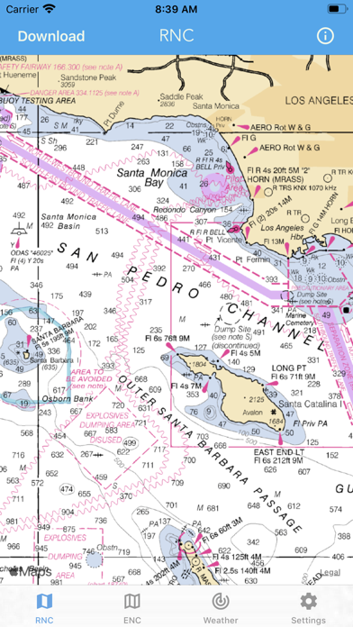
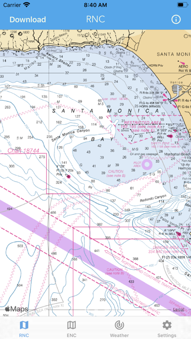
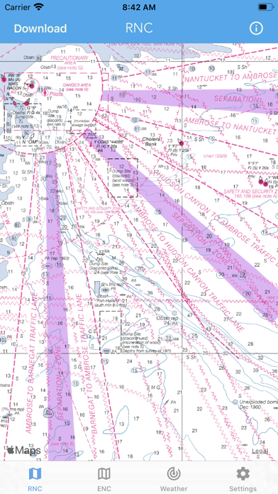
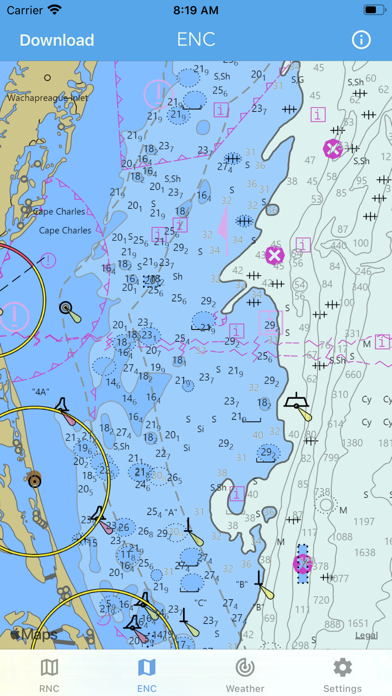
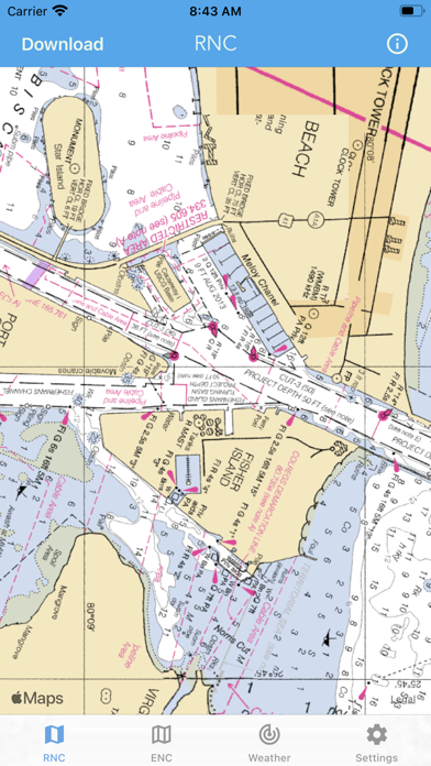
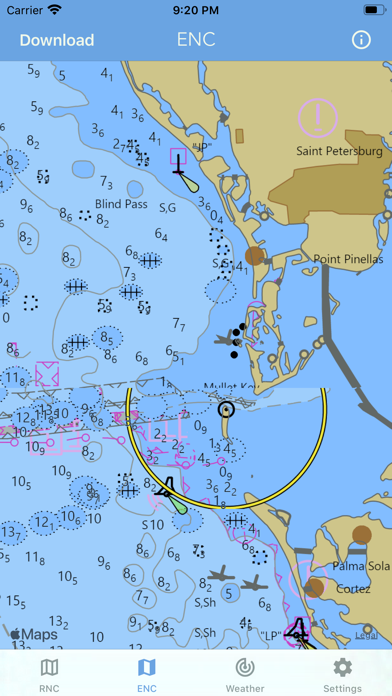
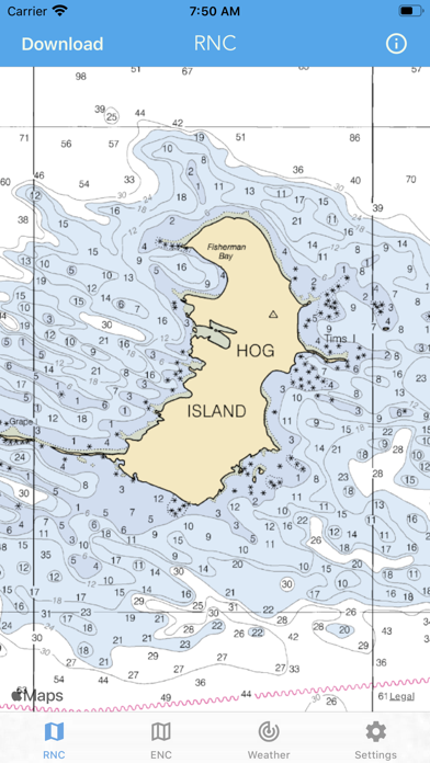
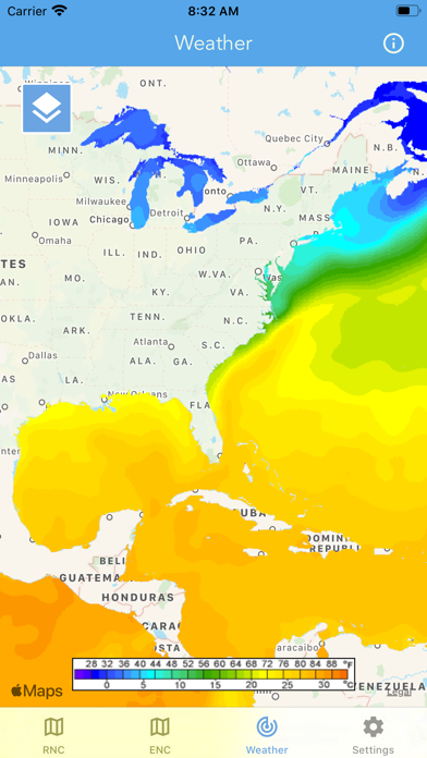
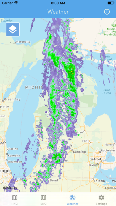
Main Features Include: + NOAA Electronic Navigational Charts (ENC) + NOAA Weather Map Overlays -- ELECTRONIC NAVIGATION CHARTS -- Electronic Navigational Charts (ENC) are vector data sets that support all types of marine navigation. + All charts are available to download for offline use + Chart format options include: NOAA, ECDIS ENC charts display the following information: + Buoys, Beacons, Lights, Fog Signals, Radar + Natural and Man-Made Features + Services and Small Craft Facilities + Seabed, Obstructions, Pipelines + Depths, Currents + Port Features + Traffic Routes + Special areas NOAA updates the ENCs for Notice to Mariners on a weekly basis. Timing of their availability is not guaranteed. The ENC charts displayed in this app does NOT meet federal chart carriage regulations for regulated vessels. Users should consult the Code of Federal Regulations for current federal chart carriage requirements. -- NOAA WEATHER MAP OVERLAYS -- + Weather Radar + Sea Surface Temperature + Significant Wave Height + Wind Speed & Direction + 12-Hour Rain Probability + Lightning Strike Density + Air Temperature If you have any questions, please email support@lwbrandsllc.com
새로운 소식
+ Optimized for iOS 26 + Fixed a few bugs Thank you for the positive feedback!
상세 정보
- 개발사
- LW Brands, LLC
- 주 카테고리
- Navigation
- 현재 버전
- 1.15
- 버전 출시일
- 2026-07-16
- 최초 출시일
- 2018-08-06
- 용량
- 14 MB
- 연령 등급
- 12+
- 가격
- USD 8.99
- 언어
- EN, FR, PT
- 번들 ID
- lwbrands.nauticalcharts
- 현재 버전 평점
- ★ 4.62 (3,768)
- 첫 수집
- 2026-05-28
메타데이터 갱신 2026-07-18
순위 히스토리
무료 기준 · 최대 90일 · 상위 5개 카테고리 표시 (Y축: 순위, 낮을수록 상위)
순위 히스토리 데이터가 없습니다
무료 순위
순위 없음
유료 순위
순위 없음
이 개발사의 다른 앱
National Hurricane Center Data
Weather · ★ 4.8 (74,950)
Marine Weather Forecast Pro
Weather · ★ 4.7 (16,023)
NOAA Marine Forecast & Weather
Weather · ★ 4.7 (4,907)
Topographic Maps & Trails
Navigation · ★ 4.6 (2,810)
River Levels & Flows
Weather · ★ 4.6 (2,620)
Wildfire - Fire Map Info
Weather · ★ 4.4 (1,713)
Great Lakes Boating Weather
Weather · ★ 4.6 (1,408)
Topo Map & Hiking Tracker
Navigation · ★ 4.7 (1,357)
유저 리뷰
Working only in USA don’t purchase
This app looked so promising to me. So I purchased it, downloaded it. And all it does is show a very basic map. Oh, I can pan over to the Atlantic but it literally shows nothing more than my iPad’s Maps app does. Less in fact! I sure hope I missed something, but I don’t think so. Ugh!
I bought hoping to get more insights on bays e.g. Tampa Bay and also rivers. No such luck with this app. If you go offshore, seems alright. I don’t go offshore, so this app is useless for me.
Good renderings of the electronic charts. I wish it wouldn’t switch to the lower resolution rendering of the map so readily when I zoom out.
Easy to use, no passwords right when I need it. Perfect.
After looking around to purchase some charts I found this app. Worth every penny. Great tool to have in addition to my electronics.
Nice to have a mapping program that doesn’t take a computer genius to figure out. All I wanted was maps I can use to see where things are without the big whistle and bells. And the big $$$$
Downloading charts for offline use crashes app randomly on a fully updated iPad. Wish there was a trial version that I could have used BEFORE I threw away $8.99. App deleted, money wasted.
Used it in Destin FL to navigate a rented pontoon boat.
I mistakenly thought that this was a legitimate NOAA product. Turns out it uses NOAA charts but is in no way associated with NOAA. It has absolutely no tools available for plotting routes in advance or tracking while underway. Useless for advance plotting and dead reckoning.
변동(신규 진입·급상승) 감지된 앱에 한해 Apple RSS 최신 리뷰를 수집합니다.